18 May 2012

So Many Views and so Few Eyes!!

Well our time in Patagonia and SE AZ are coming to an end.  We are now trying to rush in all those things we wanted to do but have not done YET!  We have been truly blessed by this opportunity at the Patagonia-Sonita Creek Preserve!  BJ has become an accomplished entry level birder and has really developed a love for it.  I have enjoyed some fantastic off-roading in our Jeep that has taken us to some beautiful locations with memorable views.
The Patagonia Mountains soar over the town of Patagonia and Red Mountain is, at 6300 feet, about 2100 feet above the town and the major peak in the majestic range to the south.  
Red Mountain Foods with Red Mt behind it!
From top of Red Mt looking down on Red Mt Foods and rest of Patagonia!


To the northeast, the Santa Rita mountains dominate the region with Mt Wrightson at nearly 10,000 feet.  Mt Hopkins is just about as tall and has an observatory with three different telescopes on top plus a geocache I will have to get next time we are here!!
Mt Wrightson in the Santa Ritas!
Santa Rita mountains in background


We drove thru Box Canyon to the north side of the Santa Ritas one day.  Box Canyon Road was a gravel road carved into the side of the mountain.  On one side you had a cliff raising above you and on the other side a cliff dropped away to the creek about 300 feet below.  The alternate route going around the west end of the Santa Ritas was nearly twice as far, approximately 70 miles rather then nearly 40 miles to Madeira Canyon and was not nearly as scenic!
Box Canyon Road
More Box Canyon Road
Box Canyon at night - only those reflictors between you and the bottom!


On the other side of the Santa Ritas was Florida Canyon and Florida Workcamp.  Except I have learned while out here that all my life I have been mispronouncing my home state – it is pronounced FLO-REE-DA.  Duh, who woulda known!  The Florida Trail climbs thru Florida Canyon by MT Wrightson and eventually to Madera Canyon which is an especially beautiful canyon that we visited several times and will do again when we return to SE AZ.
That is pronounced FLO-REE-DA 
Well marked trail.
We hiked up the Florida Trail for aways, BJ was looking for birds and I was just looking for views.  Green Valley was out in front of us and on the other side was I-19 that runs between Tucson and Nogales.
We got excited when we saw a large body of water on the other side of the valley and I-19.  We were envisioning a great rec area and some kayaking opportunities.  We wondered why we had not heard of this apparently large  
lake.  Well we eventually found out it was water from a mining operation and was not open or safe for use.  Apparently remediation of the problem is under way for some undetermined amount of time! 
The view of Green Valley from about half way up the Florida Trail. 

Of course we have bird pictures on top of bird pictures.  BJ has become a real birder while we have been here.  She has i-bird loaded on her i-phone to help her identify birds by their songs, She has books and lists and pictures and descriptions and great fun with bird searching!  If any visiting birders ask me too much I tell them I am a parrot – I can repeat what I have heard but don't ask me any questions and I refer them to BJ.
A hawk on her nest!
The Vermilion Flycatcher can be spotted easily with its bright red colors and black mask!


Our 3 month tour ends next week and we are looking forward to resuming our travels but our time here has been some of the best since we hit the road.  We will definitely return to AZ and most certainly to SE AZ!  It is a magical place full of beauty and dramatic views. 
We may even buy a place to stop and spend some time if we decide to slow down on the travelling!
A fixer upper for us - just need to add a carport for the RV!

14 May 2012

A Day on the Water (At Last)

It has been 2 Dec of last year since we have had the kayaks in the water!  Since arriving here at Patagonia we have been wanting to get to Patagonia Lake State Park about 6 miles west of us to do some paddling.  Finally we thought the weather matrix was aligned for us, it was our day off, it was warm, and no crowds at the popular state park.  We loaded the kayaks back on the Hullavators and headed to the lake.  The boat ramp was empty, the sky was clear and the sun was shinning warmly on us!  (We ignored the chilly water, as we were not planning on being in it on this day!)

The launch ramp at Patagonia Lk State Prk


We dropped the kayaks in the water, moved the Jeep to parking and headed out of the cove where the boat ramp was!


Patagonia Lake is not a large lake but is longer then it is wide!  From the dam it looks like a "Y" with two "legs" breaking off from the main body of water. The lake was formed in the 1950's when Sonoita Creek was dammed up to create a recreation area.  The shoreline was formed as the dammed up creek filled two canyons behind the dam.  That made for some interesting shoreline scenes.  The canyon walls dropped directly into the water most of the way around the lake.  Plants and cactus grew right up to the waterline!  

Shoreline
There was some beach at the far end of the lake away from the dam, but that was about all.  Water sports like boating and fishing, skiiing were popular as was kayaking.  We saw another couple kayaking and I expect as the weather warms, and especially on the weekends, it will be more crowded then we saw it on a Tuesday.


More shoreline!


BJ on the water!
We paddled west toward the dam enjoying the kayaks, the sun, and the views.  At the dam which is a very simple affair we met some other water lovers that were hanging out around the dam enjoying a day at the lake.
My kayaking buddy!

Some more fun guys at the dam!
He is thirsty!


So after about an hour on the water the wind suddenly picked up gusting hard from the west!  I had to paddle hard to get back to the cove where the boat ramp was and BJ had been in the other leg and was being driven by the wind againest the bank rather then in the direction of the cove.

However, we both made it back and we loaded the kayaks and headed back to the RV.  Despite the rough ending we enjoyed our time on the water.


Always at home, no matter where we are!!

25 April 2012

A Day on the Mountain

Less then two mile from the Preserve we are volunteering at there is Salaro Canyon Road, another unpaved mountain road heading north into the Santa Rita Mountains.  About 4 or 5 miles up the road Squaw Gulch Rd turns off to the east and several mile up that 4-wd road is the base of Squaw Peak.  On top of Squaw Peak there is a geocache, Native American Women Peak by name.   And since it is a fairly high peak, clearly not the highest, I figured it would offer some great vistas with beautiful picture opportunities!  So off we went on one of our days off.  This was actually our second time to target this geocache.  But, several week earlier we had tried it and found out that shorts were not the uniform of the day for this adventure. 
On Salaro Rd with Squaw Peak in upper left
We enjoyed the ride up and could see the peak in the distance grow closer as we headed up Salero Canyon Road.   Once we turned onto Squaw Gulch Rd however it was time to shift into 4 wheel drive and not long before it took granny low to proceed!  But, the Gray Ghost handled it well and we enjoyed the ride (well at least I did – BJ walked part of the way)!

Squaw Gulch Rd - BJ in front walking instead of riding
So we got to a parking spot at the base of the peak, GPS said we were about .35 mile from the GC (geocache) and we noted it was all up hill (very uphill) from here!  
We shortly ran into a wash (dry creek bed) that was heading in about the right direction. So we headed up it for aways then took off to the left climbing a pretty steep gulch toward the peak.   Kept hoping to find a trail, but all we ever saw was game trails.  They helped some but not a lot. 
Note the trails - NOT!
                   
Finally we were about a third of the way up and BJ decided this was not for her.  She found a nice shaded flat spot near a wash and said she would rock hound while I finished the hike.  So I continued.  It did not get any easier and several times I thought about rejoining BJ and abandoning this geocache quest!   Especially when I was finally about 500 ft from the ridgeline and figured out I was working my way up the wrong wash.  I needed to be in one to the left which entailed a change in direction and increased effort. 
Finally got to the ridge line and the peak was still too my left a about 500 ft but walking along the broad ridge line was a piece of cake compared to what I had been doing.  The views were magnificent AND my camera battery was dead!  I had brought along spare batteries for the GPS, but camera took a special battery and I did not bring one.  I did manage to take some pics with my camera phone but they are not nearly as good as the "real" camera! 


Nearing the crest!
The GPS took me to a spot that was in the middle of a triangle formed by two gnarly trees and an agave bush about 20 feet below the peak on the opposite side that I came up! While I was glad to go down for a change I was not relishing the 20 foot clime back to the peak so I could go down.  At any rate I spent about 20 minutes searching for the  geocache in the triangle with no luck and getting discouraged.  All that effort with no find was not a good feeling.  However, it had been nearly two hours since I had left BJ and I knew she had left her phone in the Jeep and I knew she would be concerned about me.  I took one last look around and decided to check out a tree up the slope from the triangle I had been searching and viola there was the geocache in an sturdy small ammo box ( a common container for geocaches)! I quickly signed the log, finished the short climb back to the peak so I could start the descent! 
View from the top!
So I started down, thinking/hoping it would be a quicker and easier trip down!  Wrong, the lack of trails and the very rocky surface made it no easier going down, just a little less effort!  But, the views remained great all the way.

However, a little less then half way down I see the Jeep below starting to move!  I had visions of our trip to Mt Vesuvius several decades ago.  BJ, the kids and I had hiked from the parking lot to the rim of the volcano across the barren rock surface.  The trail wound around the mountain top.  As we descended the trail and came around the side of the mountain the parking lot came into view still way below us!  And, we saw vandals plundering our car!  Not much we could do about it and when they heard me yelling they calmly got into their car and drove off – with all our stuff.  Interestingly we had seen that same Fiat parked along the road on the way up to the parking lot.  I young couple was sitting in the front seat making out!  We got a laugh over that.  But, they got the last laugh. 


Anyway, back to Squaw Peak.  I remembered BJ's phone was in the Jeep so I called and she answered!  She had gotten tired of waiting for me – it had been close to 3 hours by now and decided she needed to get to the car in case she had to direct a rescue operation to me!   Well, I was not in need of that but I was still a long way from her time wise!  However, she made it easier as that meant I would not have to cross over the ridge to the gulch I had left her in hours ago!  I eventually reached the wash we had initially worked our way up to the gulch we had worked our way up until she stopped.  This wash was broad and relatively easy to navigate and I knew that it eventually crossed the Squaw Gulch Rd we had come in on some distance behind where the Jeep was parked. 
The "waterfall" from the bottom!
I was grateful for the easier going and decided I would follow the wash to the road crossing rather then tackle the two ascents to go over two other small washes to directly reach the Jeep.   BJ & I had exchanged several text messages progress reports as I was coming down but in this wash I was apparently not receiving a signal.  So I continued on down enjoying the trip and the beauty of these washes.  THEN, I reached what was probably a beautiful waterfall when there was water!  It seemed like it was a 1,000 ft drop, but was more like about 45-50 feet.  I did not feel like climbing out of the wash to get around the drop so I studied it carefully and decided there was some foot holds down the face of the stone front of the waterfall!  I made it down about half way and ran out of footholds but I sure as hell was not going to turn around now (as if I could)!  So I tried for a very tenuous foothold and it held – for a few seconds then I slid down the rest of the way.  Fortunately, I had noticed that at the bottom of these drops there was always an accumulation of loose sand left by the waterfall and I had noted it was a bigger and deeper pile here because of the greater drop.  So I landed on the pseudo beach and just laid there for awhile and rested.  I took the picture with my phone while I was laying in the sand at the bottom of the "waterfall" wishing there had been some real water to land in!
Some cactus flowers in wash!
I continued along the wash until I noted the road was about 20 feet up one side of the wash and I found a spot that was a quick climb so I made it.  Then I walked back up the road about 350 ft and there was the Jeep.  I tooted the horn and BJ shortly returned from a rock hunting expedition to another nearby wash! 
We thought the adventure was over for the day and with her driving we headed home.  Successfully drove back down Squaw Gulch to Salaro Canyon Rd, a downtown city street in comparison.   However, about a mile down the road we found out the adventure was NOT over!  We had a flat tire!  Just what I wanted!!
At any rate by the time we got back to the RV we had a full day and deceided we didn't need to seek any further geocaches as remote as this one was!  (But, I would still love to get back up there with the good camera rather then the camera phone!!)
 
Always at home no matter where we are!

06 April 2012

Travelling in SE AZ!

We are doing fine in SE AZ finishing our first month of a 3 month volunteer gig at a wildlife refuge in the beautiful AZ high plains surrounded by stunning mountain views. 
<<Roads are a little rough sometimes in the mountains!  BJ decided she was going to walk instead of riding with me on this road!


Sometimes the traffic is pretty heavy on the mountain roads! 


You get water where you find it sometimes.  Don't ask questions!>>>


This is Sonoita Creek, a major element of the wildlife refuge where we are volunteering.  It is one of the few perennially flowing creeks.  This time of the year it starts at the east end of the preserve and flows west but the dry wash extends for a dozen miles further east and during the monsoon season the wash and the creek will be full of water, normally 3-4 feet of water vs the 6 inches we see now.  One of the veteran hands here says he has seen it with 8-10 feet once. some years ago!

                                                                                 
I have been attending the Patagonia-Sonoita Rotary Club since we been here.  The two small towns are about a dozen miles apart and each one has less then 1,000 residents so they combined to make a club.  They meet the first two Thur in Patagonia for breakfast and the last two Thur for an evening meeting in Sonoita.  Nice club and they have a fund raiser later this month.   Their biggest fund raiser is connected to KY Derby day and held at the county fairgrounds where they apparently have horse races leading up to the Derby.  Not sure exactly how it works yet, but I have volunteered to work it that day so we will see.  They apparently net $25 to $30K each year on it and it attracts a lot of people even from as far away as Tucson! 

Always at home no matter where we are!!

18 March 2012

A Slice of Paradise

Well we have been two weeks now at Patagonia-Sonoita Creek Preserve and we are convinced we have stumbled on a rare gem of a place.  Patagonia is about 60 miles SE of Tucson in a  basin at about 4100 feet elevation with mountains surrounding.  This is the Mountain Empire area of AZ and includes Sonoita, a town about 12 miles east of Patagonia that is the heart of a recognized wine producing - an American Viticultural Area.

We are the resident volunteers at the Preserve and are responsible for operating the visitor center and assisting the visitors enjoy their stay.  This is a major birding area this time of the year and we have been averaging 40-50 people a day from all over the country.  It appears that many visitors from the surrounding area come here specifically while folks from further away include this as one of the stops on their AZ trip!

Sonoita Creek in the Preserve

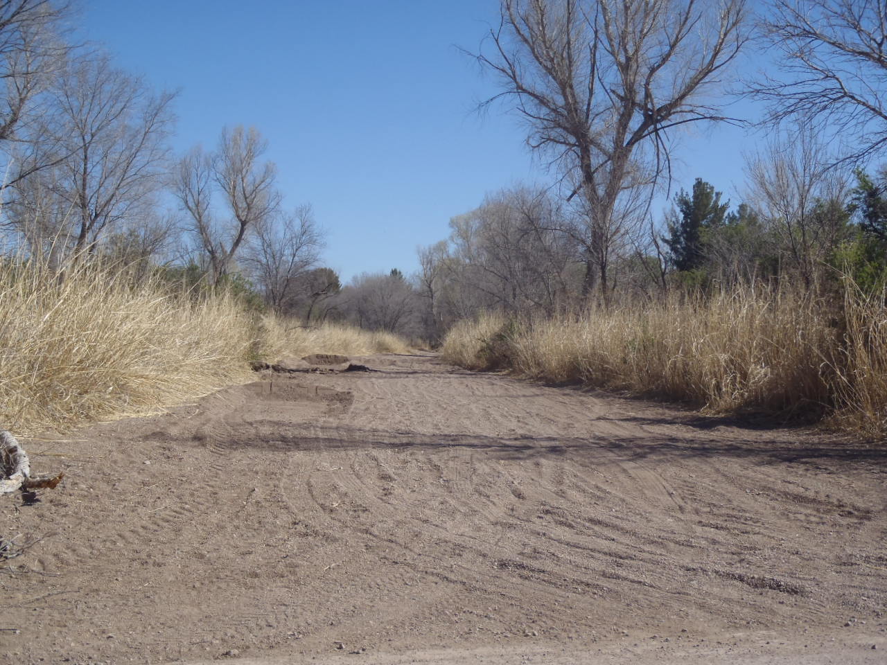
Sonoita Creek wash east of the Preserve
It is a relatively small preserve along one of the few permanently flowing streams in AZ.  While you can pretty much jump across Sonoita Creek this time of the year, I understand that during the monsoon season it usually is a raging torrent that is typically 8-10 feet deep!  This time of the year you can see the water raising out of a small spring at the east end of the property.  However, a wash extends about a dozen miles east to Sonoita.  During the monsoon season it collects water from the watershed created by the surrounding mountains and sometimes becomes a raging river!   I know, I know, you cannot imagine a monsoon season in AZ.  Well, neither can I, but there is plenty of evidence that for a short time in the Fall they get torrential rains. Apparently, that is when they get 90% of their moisture at the lower elevations.  Snow fall in the higher elevations (4500+) is another major source of water though.

The316 acre preserve is operated by the Nature Conservancy and is one of several properties in this area.  Each is a unique piece and offers the visitor a wonderful experience in enjoying natural AZ features.  We are looking forward to visiting the other properties in this and other regions.  This is the only preserve in AZ that has the volunteer resident program, but we will be looking at other Nature Conservancy properties that might have the program.  What a hoot, it would be find that Blowing Rocks Preserve in Jupiter FL has a resident volunteer program!


The Railroad Trail in the Preserve today!
The mountains surrounding the basin use to be a big mining area.  However, about 50 years ago it had declined to the degree that it was no longer profitable.  In fact, the Patagonia-Sonoita Creek Preserve was developed on land the Nature Conservancy purchased from the railroad when it went out of business because there was no more ore to transport.  The Railroad Trail is one of two main trails in the Preserve and follows along the former railroad embankment.  As well as birds, you can spot deer, javelinas, bobcats, and coatamundi along the trail.  In November a mountain lion was photographed by one of our trail cameras as it passed through the Preserve.


We took a day last week and went exploring.  Patagonia Lake is about 8 miles west of us and was formed when they dammed up the Creek in the 1950's.  It is a long fairly large lake that has value as a flood control facility and a recreation area.  It has a nice RV park and a first class boat launch, along with some great birding trails.

The bad part of Flux Canyon Road
We took Flux Canyon Road which we were advised might be difficult once we started climbing.  That was an understatement, but it was so beautiful.  BJ deceided to get out and walk while I took the Jeep, very slowly, across the worst part.  Of course I think her ulterior motive was to check out the rocks and add to her collection!


The better portion of Flux Canyon road.  Abandoned mine behind the Jeep ! 
At any rate we got past that part and road got better relatively speaking!  And she eventually did note to me that if we had taken her advice and turned around we would have missed a lot of breathtaking scenery as we climbed the mountain to a pass and proceeded down the other side.

Following are some more pics from that day of adventure.  We both are looking forward to some more exploring while we are here the next several months.

Another one of the abandoned mines

Another beautiful view!


Patagonia Lake 


Some homes high in the mountains

Always at home, no matter where we are!!

01 March 2012

Off the beaten path

Today we met some friends from the SKP club about 10:00 and headed up into the Santa Catalina mountains for a day off-roading in our Jeeps.  What a beautiful day it was for riding in the mountains.  Sun was shining all day long, not a cloud in the sky and beautiful scenery all the way!

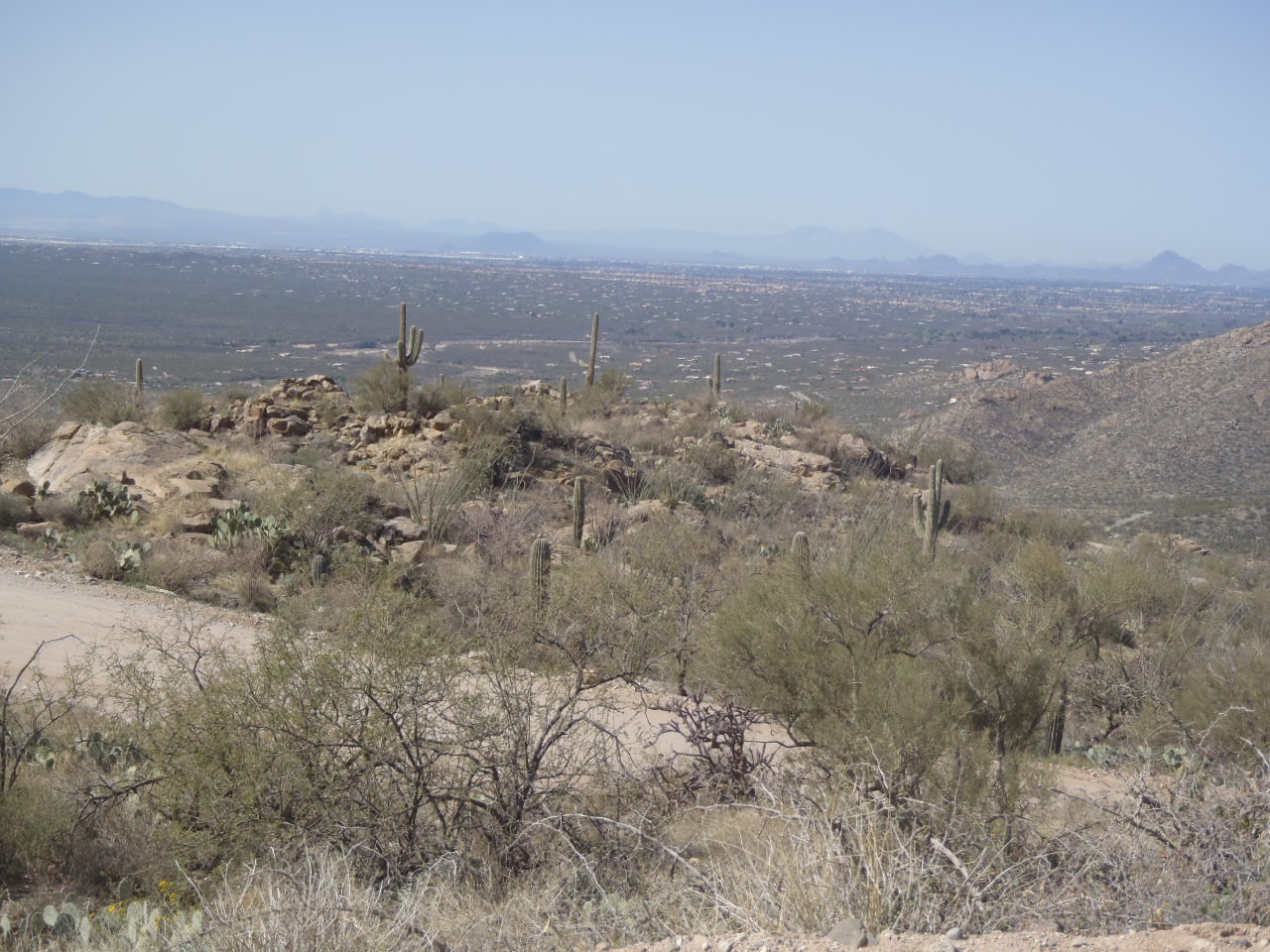
Tucson in the valley below!  We love Tucson and this is one reason!
There were 3 Jeeps and 4 couples for the day's adventure.  We did not have any particular target or destination.  One couple spends the winter here every year and had a better idea then the rest of us about the area we were headed into, so their guidance was an important component for the day.  But we all just wanted to enjoy the day as it happened rather then meet some predetermined goals.
The caravan for the day!
The road to the snow covered mountains in the background

We could see snow on the mountains in the distance and one of our crowd said we ought to go up for a snowball fight!  Sounded like a good idea so off we went in that direction!

Heading for the snow covered mountain!
Lunch break on the trail
A road hard to travel


We took a side road toward the snow covered mountains; however, it turned out to be really very rough road with large rocks making the road too uncomfortable for some of our party.

Snow covered mountains were getting closer!


A "forest"of the iconic Saguaro cactus
As we were travelling across the back road to somewhere we spotted 3 large solar panels sticking up from the countryside.  We had seen nothing to indicate  a need for some electricity so we were puzzled.


As we moved down the road we caught sight of a cattle holding area and the frame of an old non-functioning windmill so we suspect the solar panels were powering water pumps to bring water to the cattle.

We ended up on the north side of the mountains (Tucson is on the south side).  We stopped for dinner at a Mexican restaurant and then we headed back our individual ways until we meet on the road again.   We know we will see at least one couple in the Keys next winter.

Always at home, no matter where we are!!