13 August 2012

Oregon Coast - Beautiful & Cold

We moved on to Newport OR which is on the Pacific Coast in central portion of the OR.  We expected it to be cool, but not as cold as it was!  WE stayed on the beach at a beautiful state park immediately south of Newport OR.
Tide up - this is an island with a tree!
Beautiful rocky beaches
Some more dynamic beach landscape
A pretty inlet!
This was a cold and gloomy day!

Sandy beach, but lots of stuff
Horse riding on the beach was a big thing!
Wreck diving on the beach!
Temp was about 60 degrees at noon in mid-July!
Downtown Newport OR
A Newport resident!


We enjoyed our stay but were ready to leave after a week of 56-60 degree days, more often wet and foggy then sunny!  The coastal mountain range holds the cold from the Pacific Ocean close and sun  never really warms it up or at least not in July when we were there!


Always at home no matter where we are!

11 August 2012

Let's Have Some Humor!

While we are hanging out in way rural NW Alabama I was looking for something entertaining on the i-net.  I clicked on one of the "Favorites" I have listed on my browser.  It was one I check every so often, but not too frequently.

Wow, this close to the FL primary (in 3 days) I should have been watching it more closely.  It is the website of the Key West Citizen, the Key West daily paper.  It is a hoot.  It is a small daily paper, usually about 15 sheets with two sections.  They do dedicate a half-page or less to things going on outside the Keys but to an outsider the Key West news can really be entertaining!

Today's news is about a number of wanna be elected officials.  Some push around police officers doing their job, others embezzle money to finance their political ambitions, others just act normal (stupid by normal definitions!)  The comments following most stories is as entertaining as anything!

At any rate here is the link - add it to your favorites (at least until after the election in November)!

Key West news     


Always at home, no matter where we are!!

Mt St Helens twice

Our first trip to Mt St Helens was more interesting then we expected.  We were staying near Hood River OR and as we crossed the Columbia River I noted I needed to get some gas in the Jeep.  No problem, the map showed several small towns on our route.  We went on our way thru the rural countryside with beautiful forest blanketing the land in every direction.  We eventually got to the small town we had seen on the map.  Its single gas station was on the main drag (nearly the only street in town) and the pumps were blocked off as they were replacing the underground tanks. 
So we proceeded on thinking we would find a gas station in one of the other little towns on our route – WRONG!  After several small towns that barely had any residents, let alone any stores we looked at how far we still had to go.  According to the "miles to empty" reading in the Jeep we probably had enough gas – but considering the desolation of the countryside we we decided it was not worth the risk!  We turned around and backtracked first to that gas station that was not selling gas while the tanks were being replaced.  I asked where their nearest competition was and they told me – it was another 10 miles and on the road running along the WA side of the Columbia River.  It turned out to be just a few miles further from where we had turned away from the river heading to Mt St Helens.  At any rate we gassed up and while looking around found a nice little restaurant on the river and had lunch.  Over lunch we decided to resurrect our plans for the day – visit Mt St Helens!  When we had to turn around we just figured it was not going to happen that day, but with a full tank and full stomachs it sounded like a good idea again!
On this trip we were visiting the "backside" of the mountain, the south side.  The major blast on 18 May 1981 was to the north where the side of the mountain collapsed in the first few seconds of the event!  But, there was still plenty of evidence of the blast on the south.  In addition to a large swath where a molten mass of materials and melted water rushed down the side of the mountain there were downed trees and debris still very evident!  There were beautiful overlooks and the forest were recovered not far from the mountain.  This was all remote sections with plenty of recreational activities such as camping and hiking and rafting.  Part of the road was still blocked by snow and was closed!  We were there first in late June and snow was still plentiful. 
The "notch" in the middle of the peak is where the river of  debris  flowed out of the crater and down the side of the mountain!

This is part of the path the debris took.  It was much wider then this  as this is where the annual snow melt runs now.
About a week after our first visit to Mt St Helens we decided we wanted to see the "front side" of the mountain.  This is where the blast was most evident and where the most destruction was focused and where the visitors center is located.  It is on the north slope of the mountain.  It was about a 70 mile trip from Stubb Stewart State Park east of Portland to the entrance to the Mt St Helens National Monument, then another 30+ miles to the Visitor Center which was squarely in front of and about 4 miles from the summit.  
They explained and demonstrated in animated videos how in the first few seconds of the eruption a massive earthquake caused the north side of the cone to collapse and slide away so instead of having a normal cone that would direct a lot of the energy up and into the sky, you had this vast opening on the north  side of the cone and as the eruption occurred a huge amount of the energy that would normally have been expended upwards was directed outwards to the north.  This lateral force was very significant and for miles it just snapped Hugh trees like toothpicks and pushed unimaginable amounts of debris out for miles.  The evidence of the force is still visible and unmistakable.  That lateral blast force seems to be a defining characteristic of this event.  Without the lateral blast this would have still been a significant event, but the physical damage would have been more localized.  The ash would have still been spread across a vast area and created havoc. 
Mt St Helens from the north approach
From the north face -you can see where the side is gone!
After the blast this was a river of mud, boulders and debris about 70 to  100 ft  deep!
This was a tree covers slope directly in front of the blast and about 6 miles away!  Still not substantial growth, all the topsoil and trees were blown off by the blast!


Always at home, no matter where we   are!

Beautiful Oregon

We crossed from eastern WA into eastern OR and got on I-84 heading west!  We were travelling along the Colombia River.  Initially it was rolling farmland with vast golden fields of grain spreading to the horizon on both sides of the Colombia.  However, as we moved westward the fields changed into steep walls along each side of the mighty Colombia!  We were in the awesome Colombia River Gorge!  It was magnificent and on our first day it was very windy and the water was violently responding with large waves crashing into the rocky sides of the gorge.  I-84 and the railroad ran along the southern side of the gorge intertwined with each other.  Sometimes the railroad was to our left and sometimes between the Interstate and the Colombia.  But, the river, with the steep gorge walls framing it, was always magnificent.  East of Hood River OR we found a state park wedged between I-84 and the railroad in the gorge.  The entrance to the state park was actually from a small rest area on I-84!
A bend in the river
View from part of the 1920's highway
As we explored the area we found that parts of a highway built in the 1920 to attract tourist to the area still existed in some parts of the gorge.  It had been a highway full of beautiful vistas along the steep gorge walls.  Today small parts of it are open to vehicular traffic and some other parts are for hiking and biking only and some of it was incorporated into the current road system! 
The beautiful Columbia River
 Wind surfing was obviously a very popular sport on the many windy days in the Colombia Gorge.  We saw many wind surfers out and the higher the wind the more surfers!
Windsurfers!
More windsurfers!
After several days enjoying the gorge we moved to a state park that was about 35 miles west of Portland, near Beaverton.  Stub Stewart State Park was the newest state park in the OR system and was well designed and located in the countryside about 20 miles south of the Columbia.  Portland OR is a port city on the Columbia and we saw impressive harbor facilities on the Columbia in Portland. 
Stub Stewart State Park has beautiful trails thru magnificent forests with trees that seem to reach into the blue sky above.  For hiking through the beautiful forest you are rewarded with some beautiful views looking out over seemingly endless beautiful verdant forests!
Beautiful view of forests reaching to forever!
Trees that grew into the clouds!


Always at home no matter where we are!

19 July 2012

Dry Falls and the Grand Cooley

Some years ago in my USAF life I spent several short stays at Fairchild AFB in Spokane WA!  During one of those trips I had some time off and myself and coworker drove west.  I remembered two significant things from that day trip – Grand Cooley Dam  and a magnificent 1,000 ft. deep gorge that was very wide! Since we have been out west I have been looking for that gorge.  My coworker, Lenore, who we spent last Thanksgiving with doesn't remember the gorge!  BJ is beginning to think I am crazy – so what's new! 
At any rate while at Fairchild AFB on this trip BJ and I took a day trip out to Grand Coulee Dam and I kept asking around and finally found Dry Falls!  It was just as magnificent and they had expanded the roadside pull-off from just a spot for 3 or 4 cars max to a small State park with a visitors center and educational displays around the edge of the parking lot looking down into the gorge.  And, the geological history behind this gorge is really interesting.
Dry Falls across the center of the pic. Imagine a wall of water  3 times as high as Nigrara Falls and 3 miles wide rushing over it at 65+ mph!
The first picture is from the parking lot looking across the 900 ft. gorge to the Dry Falls.  During the last several thousand years of the last glaciation of the North American continent a large ice dam would form periodically across a valley near Missoula MT.  This ice damn was a thousand feet high and Lake Missoula formed behind it.  The lake had half as much water as in Lake Michigan!  Eventually the water eroded the ice dam and when it gave way the water rushed toward the Pacific scouring the land as it went.  Another smaller, but still large dam on the Upper Columbia River Basin sometimes was also a factor that increased the water flow. 
The gorges formed by these massive floods are called Coulees and Grand Coulee is the largest of them all.  Thus the name of the dam built across the Grand Coulee.  Debris included boulders as big as houses and anything else in its path!  Including soil.  When it got to the mouth of the Columbia River, mountains on each side of the mouth forced water to back up in the valleys behind the mountains! When the flow slowed, a lot of the sediment dropped out.  In the case of the Willamette Valley running north-south from Portland to Eugene the deposited soil created a rich, fertile valley that today is a cornucopia of produce!
Banks Lake, the irrigation reservoir
Back to Dry Falls! When the water from Lake Missoula reached what we call Dry Falls it was moving along at 60+ mph and was about 3 miles wide and nearly 1,000 feet high.  Geologist today estimate that flow had more water then all the rivers of the world today!  Dry Falls was originally 20 miles downstream from where it is today.  They estimate it took Lake Missoula about 2 weeks to drain.  That is a lot of water quickly moving across the land! The force of the water over the hundreds of time this happened carved the rock under the falls and when it collapsed the new edge was further back upstream! 
Grand Coulee dam
Several miles south of Dry Falls at Coulee City a dam has been built that backs the water up into a reservoir that reaches north nearly to Grand Coulee damn.  However, this is an irrigations reservoir only and can be replenished by pumping water up to it from the reservoir behind the Grand Coulee dam if necessary.  Interestingly, the pumps can become generators if the reservoir becomes too full, water can be drained  from it thru the pumps which will generate electricity as water is moved from this reservoir (Banks Lake) to the much larger reservoir behind Grand Coulee dam.  
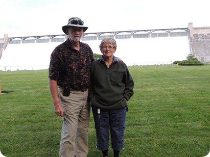
This was the addition that doubled its elec generation capacity, added in 70's
Us waiting for the light show!


In the evening they had a laser light show at 10 PM.  They projected multicolored line drawings on the white water flow of the dam and gave you the history of the Columbia River Basin from ancient times to today.  We had seen/read most of the history in the Visitors Center and other displays so it was not that interesting to us, but if Reagan and Addison were with us that would be different!


Always at home no matter where we are!

17 July 2012

Canyonland National Park

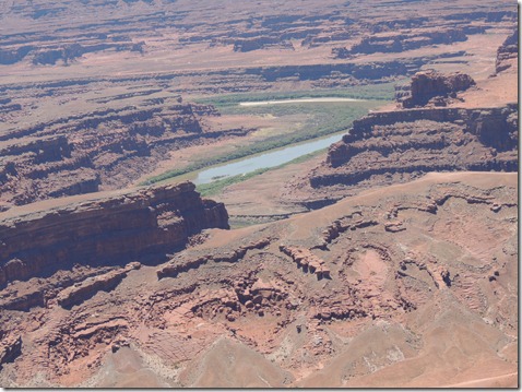
Canyonlands National Park is about 30 miles north of Moab UT and is an entirely different, but no less dramatic and beautiful landscape then Arches NP!  When the sea drained it was flat level plain for as far as the eye cold see.  But there were 3 distinct layers under that level landscape! As the area weathered over the millennia 3 different and distinct levels formed that are very evident today.  The top part is the hardest rocks and is the level we were on.  About 1000 ft. below is was the next level that is a vast plain with deep gouges in it.  Those gouges were worn in by water and flowing across the land and at the bottom of theme is streams and also the Colorado River in the biggest and deepest gouge/gorge!
An overview looking down on the next level with the gorges carved in it!
The Colorado River winding thru the bottom of the landscape!
Another view showing the levels!
The winding road up to the top level!
These two buttes were named over a  100 years ago the Monitor and the Merrimack!
 Always at home no matter where we are!      

Arches National Park in Moab UT

We spent 3 beautiful days in Moab UT after the beautiful drive through Monument Valley!   Moab is home to two national parks (Arches & Canyonlands) and one equally beautiful state park (Dead Horse).  Individually and collectively they are all magnificent, beautiful examples of the western terrain.  They also are a tribute to early pioneers who insured they were preserved for us to all enjoy.  Let's hope our descendants can say the same for us 100 years from now!
The road to Moab from Monument Valley is just more dazzling sights, one after the other.  Once in Moab we had a little confusion as to where our campground was.  Due to some phone number confusion we were talking to one RV park getting directions to it and looking for another completely different park.  Eventually we got it all worked out and got parked in a nice park on the south side of town.
The next day we headed out to Arches National Park which is immediately north of town, just over the Colorado River.  It had a 15+ mile loop road that took you to many beautiful geologically beautiful sights!  This whole area was the once the bottom of a huge salt water sea.  As the sea drained and subsequent weather events occurred the land was worn and washed away with the harder, more durable parts remaining and softer materials being wash away and Arches continues to be affected by the weather. 

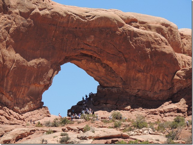
One of many arches!
And another!
A dual arch!


A favorite gathering place!


There were many other impressive structures in Arches NP besides the arches.   


Balanced for the ages!

Another balancing act!

A spire!


My sister's dogs, Chloe & TD were always good travelling companions !


And could be an attraction themselves!

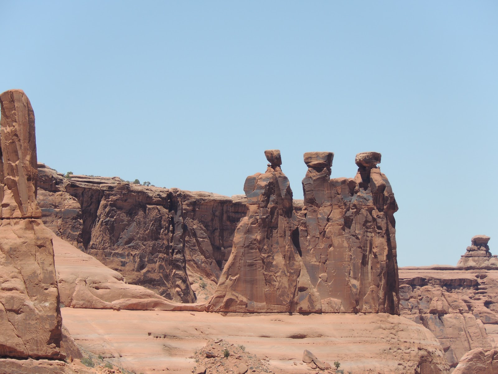
Three wise man formation

And a baby arch that will grow up in a dozen centuries or so to a big arch!
Always at home no matter where we are!