|
| Little Wild Horse |
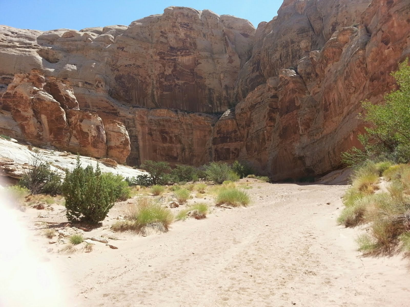
We are in the magnificent, beautiful canyon lands of southern Utah again and loving it! We first went to Green River, a small town on the river at I-70. Found a nice place to park Tucson in the Green River State Park and then BJ and I started exploring.
We decided to hike two nearby slot canyons near Goblins State Park. These slot canyons were marked as easy, not needing any special skills to access them. Little Wild Horse Canyon and Bell Canyon were each about 4 miles hikes - we planned on doing one of them, probably Little Wild Horse Canyon which was a little more effort then Bell Canyon. A quick look (first mistake) at the map and literature made it appear Little Wild Horse was a loop trail and Bell Canyon was a trail off that loop and back to the starting point also. Total combined length was allegedly 8 miles and BJ kept talking about lets do both! It was a bright sunny day with projected temps in hi 80's, maybe even low 90's! But, oh so dry!!
So we drove the 50 miles over to the canyons and loaded up with water; my camel;back and several bottles of water in BJ's fanny pack and some snacks. Left lunch in the Jeep as we were getting an early start and would be back in time for lunch!
So we walk nearly a mile from the trail head to the beginning of the canyons. At this entry point there is one wide entrance but a big permanent mud puddle about 30 feet long and 20 feet wide between two vertical rock walls. To get around it you scrambled up a narrow trail on the left side. Much of this short trail was no more then a foot path on stone slopes, very steep in some places, but short. When you came off the this steep path which took you up about 75 feet over the puddle and well past it you were back down about your starting level and you could go right into Little Wild Horse Canon or slightly to the left into Bell Canyon. We opted for Little Wild Horse with thought we might do Bell Canyon after lunch!
We knew there was some impediments in the canyon but we felt we could surmount therm or turn around and come back! So off we go! There were 3 other cars in the parking lot so we expected to see a few people on the way. We ran into some easy impediments that we managed to crawl over or around off drop off of safely.
 |
| The path over/around the mud puddle! |
 |
| Entrance to Little Wild Horse Canyon |
 |
| Plants seemed to grow out to rock! |
 |
| Sometimes the path was clear and easy! |
 |
| Sometimes there was enough room! |
 |
| Other times it was narrow |
 |
| Really narrow! |
 |
| Other times we had to climb up then crawl under! |
 |
| Sights were always magnificent! |
 |
| Sometimes it was a water hazard! |
These canyons are part of the San Rafael Reef which is part of the
San Rafael Swell in southeastern UT. As they explained to us several years ago at nearby Capital Reef National Park, the term reef comes from the days when the wagon trains were crossing the continent. Many of those folks had seafaring backgrounds and in the sea when there is an impediment to your trip it is usually a reef so these massive uplifts that blocked there way were called reefs and many were named! The swell refers to an uplift in the land caused by subterranean effects millions of years ago!
So this reef term has me thinking of scuba diving which I have missed except when we are in the Keys! I am comparing these dry reefs with the wet ones I have dived off the SE coast of FL and the Keys!
 |
| The family we met on the trail! |
About two hours in we come across the first other folks we have seen. A young family from British Colombia including two kids maybe 1st and 3rd grade ages. We stop and chat with them, the Mom shows me the map and where we are on it! I also read the paragraph I had skimmed earlier! It says Little Wild Horse is 4 miles long and to return along the path you took in - no loop!!!
So we were about half way through the canyon. BJ and I went on and shortly, less then 1/4 mile came to a dead-end - so we thought. A puddle under a rock overhang! Soon the family caught up with us and the Mom pulled out her map again and studied our surroundings and said "No it cannot be the end, we are here!" The son went up close and sure enough there was a crack with daylight in the back of the overhang behind the puddle. A bunch of limbs had been placed on one side to act as a bridge over the edge of the mud puddle!
 |
| We are following the family thru this widening crack behind the mud puddle under the overhang! |
The family goes on, those little kids are like monkeys climbing up and over thinks like they were not there! BJ and I continue along at a slower pace. I am thinking of that last sentence in the pamphlet the mom had "Return the way you came up Wild Horse Canyon"! I am considered some of those last impediments especially the one shown below. We had great difficulty getting up this vertical rock wall! We got up to the first ledge then stood on a wobbly pile of rocks to barely reach the second level and I had to pull my self up barely while BJ hung on. Then I helped her up, but we both were exhausted by the effort! And, I was not sure going back down it was going to be safe. If the wobbly pile of rocks gave way as we came down we had about a 6 ft fall to hard rock on the bottom! BJ is less certain now about doing both canyons and I am not inclined to go back over those last few impediments for safety reason! So by default we keep moving forward hoping that were no more impediments like that last one! Good news was there weren't!
Soon we are out of the slot portion of the canyon and in more open terrain with spectacular views around us!
 |
| Resting after a difficult climb up the wall! |
 |
| "Did I come up from down there?" she says! |
 |
| A little more open space! |
We continue on enjoying the magnifcant views. However, now we were in the direct noon time sun with little shade. But, the path was clear and even though there was a slight uphill grade it was not bad. There were several info boards posted with maps marked "you are here" that made it clear we had no options but to continue on to Bell Canyon or turn around (not a feasible option for us we felt).
 |
| beautiful vistas for this part of the hike! |
 |
| Entrance to Bell Canyon ahead! |
 |
It starts narrowing down!
|
Once we got into Bell Canyon and it started narrowing down we finished up our water supply (we had brought plenty for the original planned route of 4 miles). The GPS said at this point we had been 8 miles and the signs were clear the Bell Canyon was 4 miles long! But, once in the canyon we did get shade so that made it a little cooler.
 |
| Shade helped! |
We plugged along. Fortunately, the impediments in Bell Canyon were not as tough as those in Little Wild Horse Canyon. Mainly climbing over boulders and/or squeezing around them. No really steep drops and we were on a slighht but steady decline! The miles on the GPS kept going up and with 12+ miles displayed the batteries died! I estimated we had about 3/4 mile left in the Canyon plus about same distance from the exit to the parking lot!
 |
| Boulders were main impediment usually! |
BJ was getting tired and lack of water was affecting her more then I so I decided I would push ahead as I could travel faster then her and get some water and bring it back to her!
 |
| One of the many signs of water! |
I foraged ahead and reached the Jeep in a little less then 45 minutes. I had told BJ if she ran into an impediment that was too bad to just sit down and wait! I was hoping she would do that, but not expecting it. I quickly loaded some water in my backpack, changed the GPS batteries and headed back, As I reached the entrance and scaled the cliff path around the mud puddle I noted a couple coming out of the canyon, I had noted there was only one other car in the parking lot and I assume it was theirs. But, I did not tarry to talk with them. I moved as rapidly as I could up Bell Canyon looking for and expecting to see BJ! By 40 minutes and a mile and half in I had not seen her and was worried! Had she gotten delirious gone back out the canyon by mistake; had she taken cover behind one of the few collection of bushes and fallen asleep, was this the place I had left her? Once I saw a particular landmark we had discussed I knew I was back where we had been. While I could not figure out how we missed each other, I felt I needed to get back to the Jeep. If she was not there I would call 911! With the adrenalin pumping I made ti out in about 30 minutes. As I approached the parking lot I could see not other cars or people in the lot and I was really getting upset.
However, once I got close enough I saw her sitting on the ground next to the Jeep. I was never so glad to see anybody in my life. What a relief. Of course she did not have any keys to the Jeep so she was glad to see me to get some water!! Best drink we have ever had together!
How did we miss each other? We finally figured it out. On the way back she missed the pointer to the cliff path over the mud puddle and she ended up at the mud puddle which was 4-5 feet down a rock face. She was too exhausted to go back the 100+ yards so she slid down the rock facing and waded across the mud puddle. Meanwhile I was up on the path above the puddle and not in sight of it and thinking in my mind she was waiting for me up the canyon!
BTW- I am not telling where she found a small sip of water while waiting for me at the Jeep. It is too disgusting! You will have to ask her!
 |
The infamous path I was on while she waded through the puddle going the opposite direction below!
|
Well, all's well that ends well is what comes to mind. We will study the maps more carefully before the next hike through some crazy UT above ground reefs! And, I am even more anxious to get back the underwater canyons I love to dive in Florida!
It was sunset by the time we got back on the road to the RV - 50 miles away!
Always at home no matter where we are!